How to create your own country
 Did you ever want to live in your own country, to make your own rules? Tired of adjusting yourself to other people?
One solution is to buy a decommissioned cargo ship, and then strand it on a very shallow part of the sea, on international waters. You need really deep pockets and an adventurous spirit to succeed with this, but what an exciting adventure it would be!
Finding a ship
The ship has to be large enough to become a small island where you can live permanently, and sustain yourself through growing of food. It also has to be large enough to not get turned over in a storm. This leaves us with large oil tankers. They are flat bottomed, and have several compartments for the cargo which will make them more stable in rough seas.
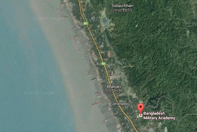
To know the price of decommissioned ships we can look at the ship breaking yards. In Chittagong, Bangladesh, there is one of the biggest ship grave yards in the world, where they run the ships full speed onto the shore, and the locals are busy cutting them up into pieces and selling it as scrap metal.
Below: The coastline of Chittagong is lined with ships.
Below: Zooming in you can see how the ships are being cut to pieces.
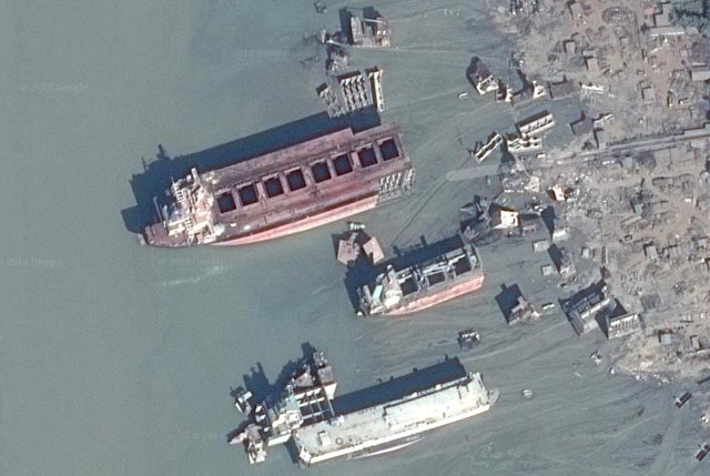
The scrap metal companies buy a medium size ship for around $10 million. Add to that the cost of sailing the ship to its final destination.
What remains is to contact shipping companies, and add yourself to the wait list of one of their vessels.
Destination
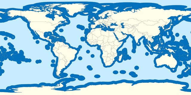
The challenge is to find a part of the ocean that is very shallow, but on international waters, which is 22 km (12 nautical miles) from the shoreline. To be safe, it should also be out of each country's exclusive economic zone, which is 370 km from the shoreline.
Below: Waters (light blue) outside of any country's exclusive economic zone (dark blue).
If possible it should be in a climate that makes farming easy, in a part of the world not afflicted by piracy, and in relatively calm waters.
How shallow does the ocean have to be? The draft of a reasonably large Panamax class tanker is 10 to 15 m.
To find the shallow parts of the oceans, we can use Google Earth to visualize data about seamounts (mountains in the oceans) from SeaAroundUs.org, and then match this with the EEZ areas, as a user has done at the Seasteading.org web site.
I have saved the data files here for future reference: ExclusiveEconomicZones.kmz, SeamountsUnder100m.kmz.
Available sites:
- Vitoria-Trinidade Seamounts, Jaseur Seamount (lat -20.712447, long -34.765506), 300 nmi east of Vitoria on the east coast of Brazil. A plateau with peaks from 3 to 50 m depth.
- Nearby Wurst Seamount (lat -34.450894, long -4.968657), 1150 nmi west of Cape Town, South Africa. 53 m depth.
- Yermolenko Seamount, Discovery Seamount (lat -43.616736, long -1.250271), 1000 nmi south west of Cape Town, South Africa. Peaks from 4 to 73 m depth.
- Karasev Bank (lat -46.049564, long -83.802147), 350 nmi west of the southern Chilean coast. 32 m depth.
- Unnamed Seamount (lat -43.312307, long -97.946063), 1000 nmi west of the southern Chilean coast. 4 m depth.
- Akademik Kurchatov Fracture Zone (lat -36.097100, long -125.184437), 700 nmi south of Pitcairn Islands. 57 m depth.
- Timkin Guyot (lat -21.468466, long -81.618081), 600 nmi south of Lima, Peru. 52 m depth.
- Dorofeyev Guyot (lat -25.900728, long -84.318184), 780 nmi west of Valparaiso, Chile. 18 m depth.
- Zasosov Seamount, Baral Guyot (lat -25.664377, long -86.568122), 915 nmi west of Valparaiso, Chile. 9 to 16 m depth.
- Unnamed Seamount (lat -25.516440, long -89.134130), 1000 nmi west of Valparqaiso, Chile. 29 m depth.
- Gazelle Fracture Zone (lat -35.901659, long 53.246586), 725 nmi south east of Madagascar. 17 m depth.
- Ritchie Bank (lat -8.334460, long 60.148550), 360 nmi south east of the Seychelles. 23 m depth.
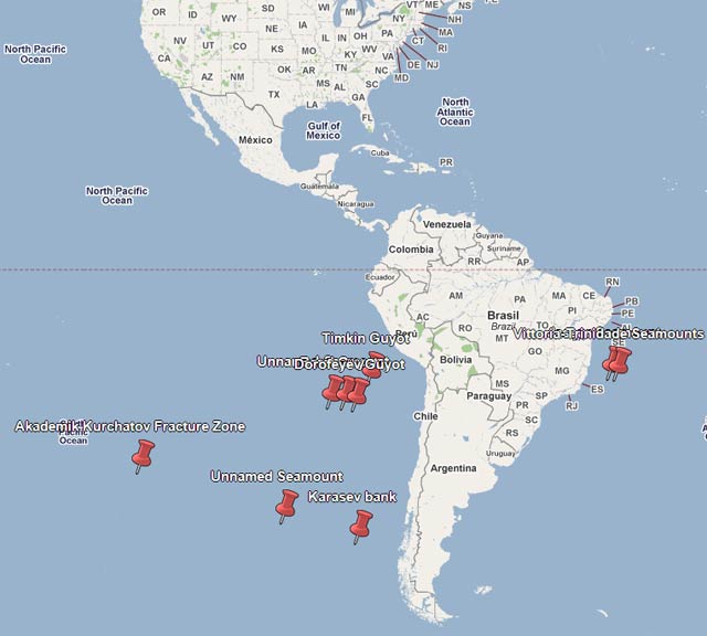
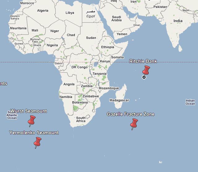
The Vitoria-Trinidade site looks like the easiest and safest option, and also the least afflicted by storms.
The ship could possibly be sailed slowly into position, and then sunken to rest on the ocean floor, by initially filling the tanks with water, and then replacing it with rocks sourced from the bottom.
But this requires the ocean floor to be reasonably flat, which might prove difficult, so a more realistic approach would be to anchor the ship using several huge anchors and long chains, and then filling up the bottom of the ship with ballast to make the ship behave well in storms.
On top of the deck you fill up with soil and plant trees and have various types food production. A Panamax ship has a deck of around 280 x 30 m, which is 8,400 m2, or the size of a soccer field.
Fresh water is made by desalination of sea water. Solar panels provide electricity. For housing the existing bunks of the ship is used.
Some obvious considerations include:
- Protection from intruders.
- Having sustainable food production.
- Protection from storms and high waves.
- Hull maintenance, to save it from deteriorating in the saline water.
- Carefully examining the site to look for geological problems (under water volcanoes, active fractures, etc).
